Applications
Ground and user applications bridge the gap between IoT data in the platform and the real world problem you’re trying to solve. They can be as simple as notifying you that an event happened, or as complex as implementing the whole logic behind a real bussines problem, including visualization, automation rules and integartion with other platforms.
More info about how to understand and use applications within AllThingsTalk IoT Platform soon to come.
Examples
Geofence
Geofence lets you define the geographical boundary, to detect when objects enter, leave or reside inside of it. You can create multiple boundaries and track multiple devices.
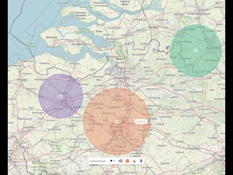
You can automate what happens as a result of a tracker entering or leaving a geofence. After selecting the device you wish to track against a geofence, you can can opt to use a virtual geofence asset (the application will create and manage for you). The boolean geofence asset will say true anytime the tracker is inside the geofence, and false when it’s outside. Then, using rules, you can automate the following steps.
Sensor map
Sensor map shows actual position of ground devices on an image. Upload the plan or a photo of your space, and add a pin for each device. Set a color for each device state you’d like to show, and share the Sensor map with others.
Check out a live Sensor map showing the availability of desks at our office
Location history
Visualize where the devices has been travelling and sensor data that occured at the time.